Moored-ships monitoring in the Outer Port of A Coruña
The marine conditions at the location of the Outer Port of A Coruña in Spain are very harsh, with a wave height up to 15 metres. The Port Authority decided to start a project to characterize the movement of moored ships and define the limiting operating conditions and the influence of the marine and climatic conditions over ships. A high-precision system for measuring the position of the ships was needed.
The project was commissioned to Siport21, the GEAMA research group from the University of A Coruña and the company Aquatica Civil Engineering.
Combining GPS and RTK
The main features of the port are 3.5 km of seawall, 2300000 m2 of sheltered water and 1500000 m2 of harbors.
The project members decided to use a system based on GPS (Global Positioning System, measurement equipment owned by Siport21) along with the RTK (Real Time Kinematic) technology. This combination provides centimeter accuracy. These systems are made up of a base station and mobile stations. The base station provides the correction of the GPS signal.
The harsh environment sets high reliability and precision requirements for the radio modems, so SATEL was chosen as a partner. The radio modems used in this project were SATELLINE-EASy. They offer long-distance reliable communications in real time and are scalable for both point-to-point solutions and complex communication networks.
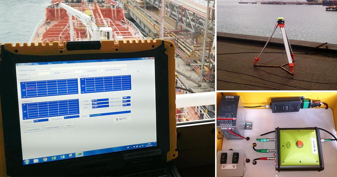
Images by Siport21
Reliable predictions
Thanks to the GPS-RTK system, the movement of the ship has been metered with high accuracy. Now it is possible to give reliable predictions of the behavior of ships depending on the waves.
- Accurate determination of the 3 degrees of angular displacement of the ship
- Precise determination of the 3 directions of rotation of the ship
- Metering accuracy: 3 cm
SATEL Iberia S.L. was in charge of this innovative research project.